Way Point Tool
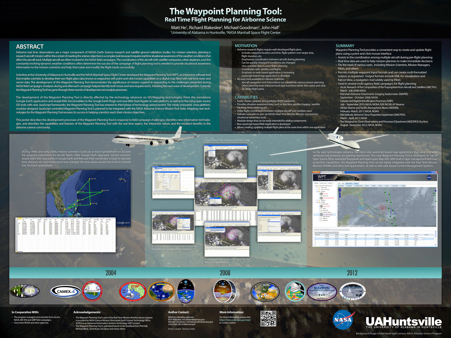
Airborne real time observations are a major component of NASA’s Earth Science research and satellite ground validation studies. For mission scientists, planning a research aircraft mission within the context of meeting the science objectives is a complex task because it requires real time situational awareness of the weather conditions that affect the aircraft track. Multiple aircraft are often involved in NASA field campaigns. The coordination of the aircraft with satellite overpasses, other airplanes and the constantly evolving, dynamic weather conditions often determines the success of the campaign. A flight planning tool is needed to provide situational awareness information to the mission scientists and help them plan and modify the flight tracks.
Scientists at the University of Alabama-Huntsville and the NASA Marshall Space Flight Center developed the Waypoint Planning Tool, an interactive software tool that enables scientists to develop their own flight plans (also known as waypoints) with point-and-click mouse capabilities on a digital map filled with real time raster and vector data. The development of this Waypoint Planning Tool demonstrates the significance of mission support in responding to the challenges presented during NASA field campaigns. Analysis during and after each campaign helped identify both issues and new requirements, and initiated the next wave of development. Currently the Waypoint Planning Tool has gone through three rounds of development and analysis processes.
The development of this waypoint tool is directly affected by the technology advances on GIS/Mapping technologies. From the standalone Google Earth application and simple KML functionalities, to Google Earth Plugin and Java Web Start/Applet on web platform, and to the rising open source GIS tools with new JavaScript frameworks, the Waypoint Planning Tool has entered its third phase of technology advancement. The newly-innovated, cross-platform, modular designed JavaScript-controlled Waypoint Planning Tool is planned to be integrated with the future Real Time Mission Monitor (RTMM) platform. Adapting new technologies for the Waypoint Planning Tool ensures its success in helping scientists reach their mission objectives.
