Guide document for two SANDS datasets published
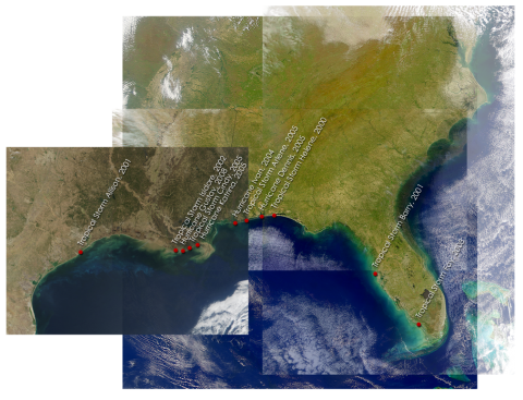

The guide for two Sediment Analysis Network for Decision Support (SANDS) Landsat datasets was published. These datasets include the Sediment Analysis Network for Decision Support (SANDS) Landsat Geological Survey of AL (GSA) Analysis and the inputs for this dataset Sediment Analysis Network for Decision Support (SANDS) Landsat Geotiff. The Geological Survey of Alabama (GSA) analyzed changes in the coastal shoreline and sedimentation using Landsat GeoTIFF images as part of the Sediment Analysis Network for Decision Support (SANDS) project. The daytime geoTIFF images from Landsat 5 and Landsat 7 were analyzed for sediment re-distribution after a hurricane over the Gulf of Mexico coastline in Alabama and part of the Florida area having coordinates 31 to 27 North latitude and 90 to 84.25 West longitude. These are seasonal data for storms from 2001-2008. In addition to the analyzed files, the data files include the ESRI files for zipped bands and grids, metadata, and storm temporal information for the sediment analysis images.
- Log in to post comments
