Cloud-based Analytical Framework for Precipitation Research (CAPRi)
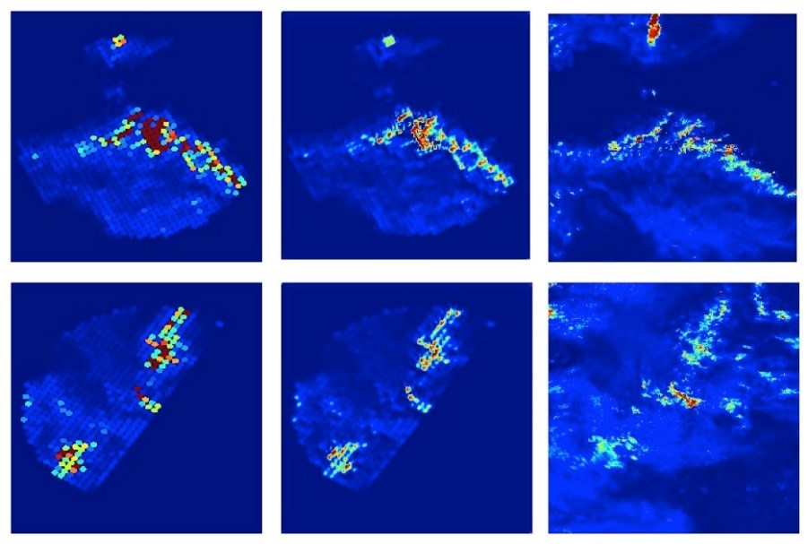
The research focus of this project will be to develop a Deep Learning application to enhance the resolution of GPM data for improved identification of convective scale precipitation features, particularly outside the range of ground-based weather radar. This resolution enhancement technology is called super-resolution or downscaling. Deep
Learning Convolutional Neural Networks (CNNs) will be used to learn features that can infer high-resolution information from low-resolution variables, building on a prototype developed by the PI of this proposal in collaboration with GPM mission scientists
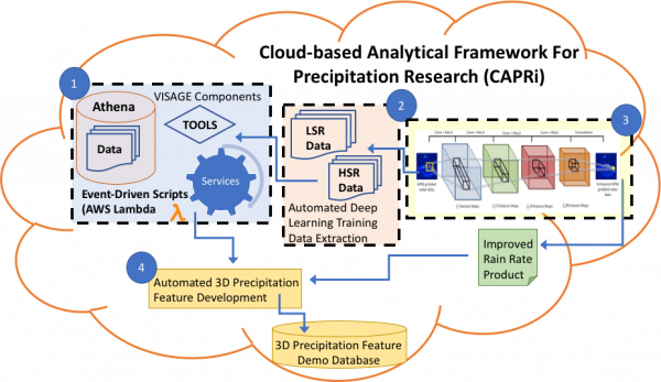
Researchers at the University of Alabama in Huntsville’s (UAH) Information Technology and Systems Center (ITSC) and Earth Systems Science Center (ESSC), in collaboration with the NASA Marshall Space Flight Center (NASA/MSFC), are developing a Cloud-based Analytic Framework for Precipitation Research (CAPRi). This framework will leverage cloud-native technologies to develop an architecture for building Machine/Deep Learning models for precipitation research.
CAPRi will host the Global Precipitation Measurement Validation Network (GPM VN) integrated with a Deep Learning framework to provide an analysis-optimized cloud data store with access via on-demand cloud-based serverless tools. CAPRi services will automate the generation of large volumes of high-quality training data required for successful development of Deep Learning models. A Deep Learning architecture consisting of Convolutional Neural Networks (CNN) to enhance the resolution of GPM data for improved identification of convective scale precipitation features, particularly outside the coverage of ground-based weather radar will be developed.
The project team will develop new tools within CAPRi to automate the complex process of deriving training/test data sets from the GPM VN. We are extending our base CNN architecture, trained with this data, to downscale the spatial resolution of satellite-based GPM DPR precipitation products from ~5km to ~1km to improve rainfall retrieval estimates from GPM DPR data in areas where ground-based scanning radar and reliable precipitation gauge observations are lacking. As a science use test case, we will develop a 3-dimensional precipitation features demonstration database to support the precipitation science community using the new datasets.


