Northern Gulf Coastal Hazards Collaboratory
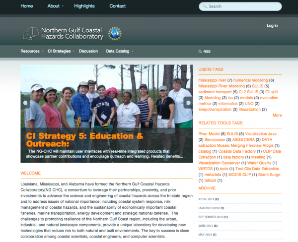
The Northern Gulf Coastal Hazards Collaboratory (NG-CHC), funded by the NSF Experimental Program to Stimulate Competitive Research (EPSCoR) Research Infrastructure Track II program, is using cyberinfrastructure to catalyze collaborative research and education and reduce risks to coastal. Researchers in Louisiana, Mississippi, and Alabama are working to advance the science and engineering of coastal hazards across the region and address problems of national importance, including engineering design, coastal system response, and risk management of coastal hazards.
In this effort, ITSC developed a collaborative environment to provide needed capabilities for simulating coastal hazards by enhancing the linkages between modeling and observations in a multidisciplinary environment. In addition to serving as a portal, the collaborative environment allows researchers to organize, discover and share information about data, models, tools and other resources; discuss project activities and results; view publications, presentations and other documents; and track the history of project activities. Both public and private environments are supported. Project management capabilities include a calendar allowing users to schedule meetings, telecoms, and other events, as well as easy access to meeting logistics, agendas and notes. The environment also provides an education and outreach area for increasing public knowledge and understanding, with project information, educational tools, and learning modules. Since communication is at the heart of science, these technologies provide researchers with easy mechanisms to share ideas, data, and findings. By enabling the close interaction among coastal scientists, coastal engineers, social scientists and computer scientists, the collaboration environment frees the researcher from the complexities of sharing and using information, allowing him to concentrate on science. This cyberinfrastructure can be applied to many other domains, stimulating knowledge discovery and change in a range of fields.
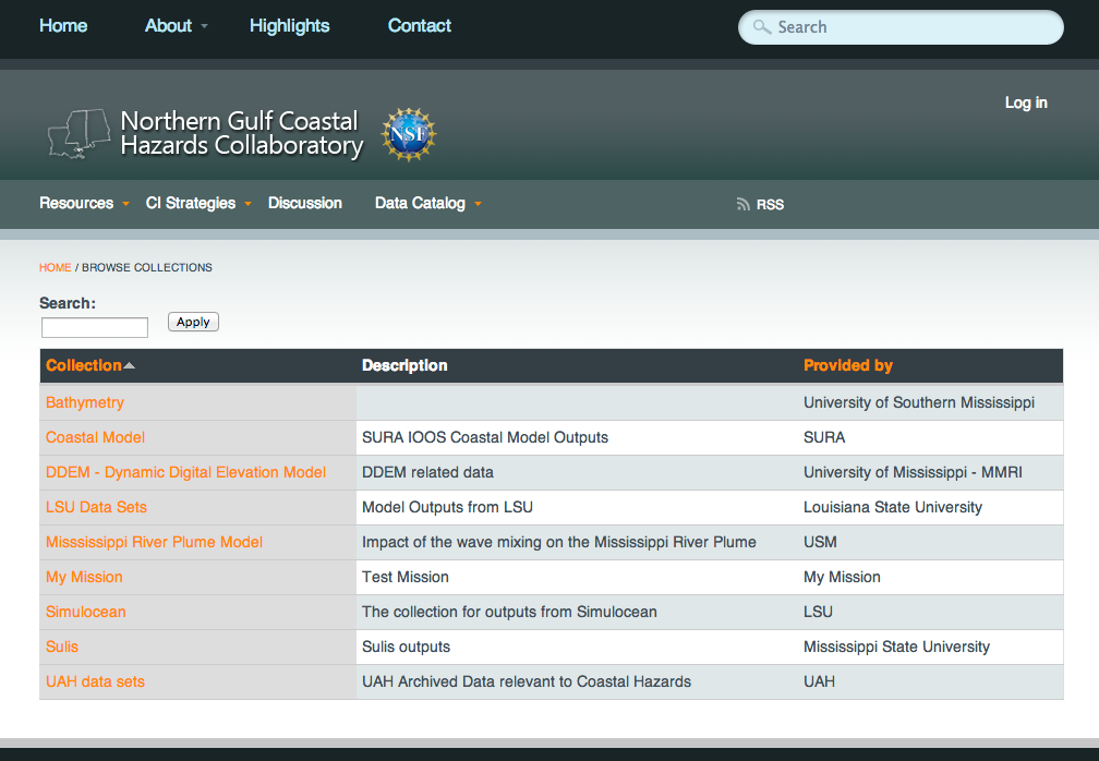
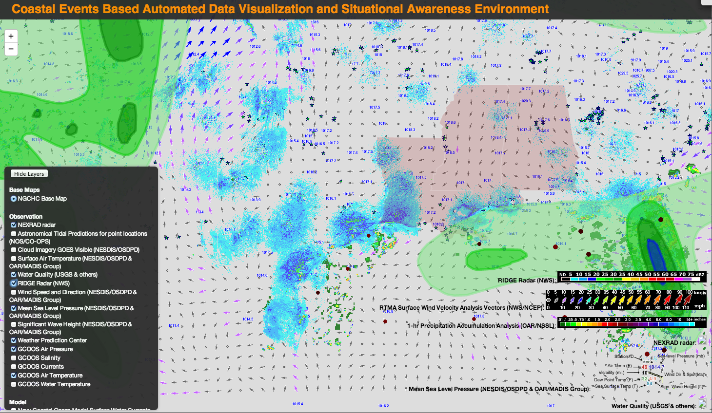
For this project, UAH developed a highly adaptable information catalog that is deployable within collaborative environments. The catalog provides users with the ability to search, browse, and discover the information at different levels of granularity (Collection and Data Granule). Automated harvesting of information for catalog entry allows aggregation of various coastal information and catalogs into a master coastal information catalog, and automated standards-based publication of catalog entries allows for existing community tools to search, discover, and eventually consume the information. Metadata-driven visualization capability has been integrated into the NGCHC metadata catalog so that users can visualize distributed data within the portal. Both the catalog and the related tools are compliant with the current geospatial metadata and visualization protocol standards, making this infrastructure interoperable with other existing standards-compliant geospatial tools and systems. Packaged together, the catalog and the supporting visualization tool provide a suite of solutions to distributed coastal data management.
UAH facilitated the staging and transfer of large data files during simulation experiments using Globus Online, a cloud-hosted Software-as-a-Service (SaaS) utility providing fast and reliable data movement services. UAH installed a GlobusOnline server to facilitate staging and transfer of large data files during simulation experiements. GlobusOnline uses the GridFTP protocol to facilitate data transfers. The UAH team is working on automatically capturing the metadata for the transferred data and publishing it to the metadata catalog. This allows researchers to discover the large simulation experiment data via the portal or other tools and use Globus Connect to download. Globus Connect, provided by the Globus development team, provides a pre-configured GridFTP client for the end-user system.
UAH also deployed mining workflows at the NSF XSEDE resources using an Apache Airavata-based science workflow management tool that can be used for constructing, deploying and executing workflows. This tool allows any application to be wrapped as a service, which can be deployed in cloud or computing clusters. This tool abstracts various XSEDE job related functionalities, hence submitting and monitoring such jobs via workflow composer (XBaya) are seamless.
A chapter describing cyberinfrastructure research performed by UAH Information and collaborators from Mississippi and Louisiana was published in Remote Sensing and Modeling: Advances in Coastal and Marine Resources, a Springer International Publishing book in the Coastal Research Library series.
Twilley, R.R., S. Brandt, D. Breaux, J. Cartwright, J. Chen, G. Easson, P. Fitzpatrick, K. Fridley, S. Graves, S. Harper, C. Kaiser, A. Maestre, M. Maskey, W. McAnally, J. McCorquodale, E. Meselhe, T. Miller-Way, K. Park, J. Pereira, T. Richardson, J. Tao, A. Ward, J. Wiggert and D. Williamson. 2014. Simulation Management Systems Developed by the Northern Gulf Coastal Hazards Collaboratory (NG-CHC): An Overview of Cyberinfrastructure to Support the Coastal Modeling Community in the Gulf of Mexico. Remote Sensing and Modeling: Advances in Coastal and Marine Resources, edited by Charles W. Finkl, Antonio H.F. Klein, and Christopher Makowski. Coastal Research Library (CRL) series, Volume 9. Springer International Publishing, pp. 365-394. ISBN 978-3-319-06326-3.


