Super Multispectral Enhancement and Radar Fusion (SMERF)
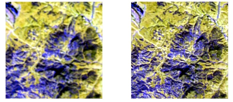
The research focus of this project will be to develop an approach for using Deep Learning (DL) with convolutional neural networks (CNNs) for improving the spatial resolution of multispectral imagery (MSI) using a corresponding panchromatic image and then fusing the downscaled high resolution MSI image with a Synthetic Aperture Radar (SAR) image. A trained CNN automatically extracts hierarchical features and learns a mapping between sets of corresponding low and high-resolution images. In addition, the CNN fuses the MSI and SAR data.
This effort improves the use of SAR and MSI data for spatial analysis of crop patterns and helps discriminate agricultural cultivates.

Researchers at the University of Alabama in Huntsville’s (UAH) Information Technology and Systems Center (ITSC) are conducting research in deep learning and super image resolution to develop an improved method of pan-sharpening MSI and fusing the results with SAR data. Results will provide an enriched Geospatial Intelligence (GEOINT) product for conducting spatial analysis of agricultural crops.
Once developed, this technology will be applicable to many other NGA domains such as foundational feature extraction and environmental monitoring applications. This technology will greatly impact NGA’s mission by improving methods to use a wide variety of RS data together to solve complex problems.